Showing posts with label Riverside County. Show all posts

Live Oak Fire CA-BDU-11386, San Bernardino County SRA/LRA 73 acres, 100% contained. [FINAL] #CaFire

Live Oak CA-BDU-Live Oak (was RRU)


Update 9-12 0900: Fire was transitioned from San Bernardino Unit to Riverside Unit at 09/12/2013 at 00:00. This will be the last report on this incident.
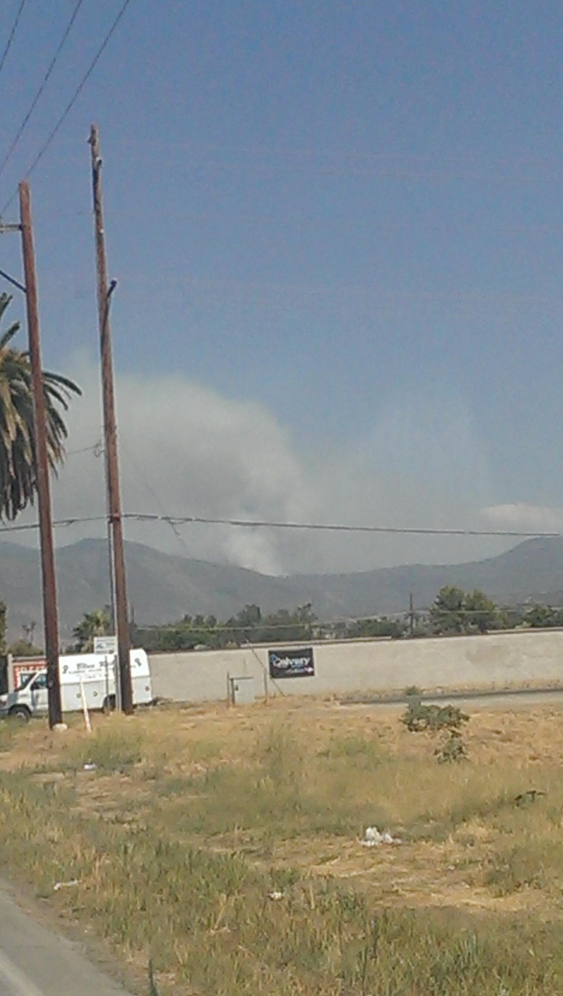
Update 9-11 1715: 30 Acres, located in Live Oak canyon south of I-10 Structures: are not currently threatened.


Location: -  Live Oak canyon south of I-10
IA Description: Vegetation Fire approximately 30 acres  
IA Resources:

ROC:Fire in Live Oak Canyon, burning actively at approximately 30 acres 
ROS: - Rapid ROS
Structure Threats: - No
Situation Concerns/Alerts: -
Situation Comments: -
Additional Resource Notes: -
Agency Website: -
Radio Frequencies: -
Weather:Temp - 82F, RH - 41%, DP - 57F,Wind - NW 4 mph, gusts 8 (Calimesa)
Web Cams: -

---------------------------------------------

CA-BDF-Little San Bernardino National Forest, Riverside County 97 acres, 100% contained, [FINAL] #CaFire

Little Fire CA-BDF-11557, CA-BDF Little FireSan Bernardino National Forest, Riverside County

Update 8/29 0900: 97 acres, 100% contained, Dinkel, Type 3 IC
This will be the last report on this incident unless conditions warrant.
Update 8/29 0900: 97 acres, 95% cont. , Expected Containment 09/08/2013, Dinkel, Type 3 IC 
Update 8/26 0900: 100 acres, 50% contained, Expected Containment 09/08/2013
Fire is burning in rough terrain with several snags within the fire boundary. Snags will be felled by Vista Grande Hot Shots once they arrive from the Gobblers Fire. Fire will be monitored during night shift due to safety concerns with snags and terrain.
Location: *
Reported Date/time: *
IA: *
ROS: Fire burning at a rapid rate of spread
ROC: 20+ acres, 0% contained
---------------------------------------------

Silver Fire Defies Popular Beliefs About Wildfire l (That older “overgrown” vegetation is the cause of large wildfires)

Silver Fire Defies Popular Beliefs About Wildfire by Burning Within the Deadly 2006 Esperanza Fire Scar
Esperanza Fire
Esperanza Fire
According to conventional wisdom, the seven-year-old vegetation was not supposed to burn

SAN DIEGO, Calif. – Defying the fundamental assumption underlying Cal Fire’s new vegetation treatment proposal (that older “overgrown” vegetation is the cause of large wildfires), the devastating Silver Fire near Banning, California, burned through invasive weeds and young, desert chaparral recovering from the deadly 2006 Esperanza Fire (see attached map). Such high fire frequency will lead to the spread of more weeds and the loss of native chaparral.

Proponents of backcountry vegetation treatments have maintained that the cause of large wildfires is unnatural “fuel” build up due to past fire suppression efforts. Younger fuels, they maintain, will not carry a fire. For example, in commenting on the July 2013 Mountain Fire near Idyllwild, UC Riverside geographer, Dr. Richard Minnich, maintained that allowing fires to consume as many acres as possible would increase the protection of nearby communities for fifty years (Press Enterprise 7/18/13). The loss of 26 homes and the burning of young vegetation by the Silver Fire contradicts Dr. Minnich’s contention that much of southern California is in pretty good shape because older vegetation burned off during a spate of wildfires over the past decade (KPCC 8/10/13).

While sounding intuitively correct, such fuel-focused perspectives are not supported by the most recent scientific research. With a rapidly drying climate and an increasing population causing more ignitions, whether the fuel be weedy grasses, young or old native shrubs, or trees, southern California wildfires will likely continue to be large and intense.

Like earthquakes, large wildland fires in southern California are inevitable. Instead of trying to prevent them by clearing large areas of backcountry habitat, we need to use strategies that have been proven to be the most effective in protecting lives, property, and the natural environment from wildland fire. Namely, create communities that are firesafe through hazard relevant zoning, fire resistant construction and retrofits, appropriate defensible space, and strategic fuel breaks (within 1,000 feet of homes) in conjunction with firefighter safety zones. For those communities in indefensible locations, evacuate the residents, then focus firefighting resources on communities that are defensible. Such an approach needs to be incorporated into Cal Fire’s proposed Vegetation Treatment Plan.

Additional information regarding the most recent science on fire is available on our website:


---------------------------------------------

Riverside County Wildfire Evacuation Information Fact Sheet #CAFIRE

#SILVERFIRE CAL FIRE / Riverside Fire Department / SBF / BLM
MANDATORY EVACUATIONS Poppet Flats, Silent Valley, Twin Pines, Twin Pines Ranch, Vista Grande, Mt. Edna, and south end of Cabazon (Peach, Plum & Eucalyptus Streets, Riza Street, Ida Avenue and Helen Avenue east to Elm Street).
 - more info

THE AMERICAN RED CROSS HAS OPENED EVACUATION CENTERS AT: Hemet High School 41701 East Stetson Avenue Hemet, CA Beaumont High School 39139 Cherry Valley Boulevard Beaumont, CA Animal Evacuation San Jacinto Valley Animal Campus 581 South Grand Avenue San Jacinto, CA
Mandatory Evacuation: Poppet Flats, Silent Valley, Twin Pines, Twin Pines Ranch, Vista Grande, Mt. Edna, and Cabazon

Update 08-08-2013 9:00 AM:
Due to the rapid growth of the Silver Fire, the Riverside County Sheriff's Department in cooperation with the CAL FIRE/Riverside County Fire Department/OES is updating the mandatory evacuation order for the following communities:

Poppet Flats, Silent Valley, Twin Pines, Twin Pines Ranch, Vista Grande, Mt. Edna, and the extreme south end of Cabazon (Peach Street, Plum Street, Eucalyptus Street, Riza Street, Ida Avenue and Helen Avenue east to Elm Street).
Preemptive fire containment measures have been started on the south side of the Larry Smith Correctional Facility in order to prevent any fire danger.

Evacuations Centers:
Hemet High School, Hemet
41701 East Stetson Avenue, Hemet, CA
Beaumont High School
39139 Cherry Valley Blvd, Beaumont, CA
Animal Evacuations
San Jacinto Valley Animal Campus
581 South Grand Avenue San Jacinto, CA

Riverside County Fire Incident Page http://www.rvcfire.org/_Layouts/Incident%20Information/IncidentInfoDetail.aspx?363

Red Cross Phone Number: 1-888-831-0031

Highway 243 is closed between Banning and Azalea Trail in Poppet Flats. 


Please use 911 only for an emergency. We have had numerous calls placed to 911 that make it harder for emergency personnel to respond to actual emergencies.

Cooperating agencies: American Red Cross, Bureau of Land Management, CAL FIRE/Riverside, California Highway Patrol – Indio, March ARB, Morongo Fire Department, Riverside County Fire Department, Riverside County Fire Office Of Emergency Services, Riverside County Sheriff's Department, USFS – San BernardinoGetting Notified Links
Nixle Alert System - Notifications and alerts from the Riverside County Sheriff https://local.nixle.com/register/
Reverse 911 Early Warning - Riverside County Early Warning System http://www.countyofriverside.us/emergencies/ews.html
MEDIA: Incident command post is now located at Noble Creek Park (Oak Valley Parkway & Elm Avenue, Beaumont)
PIO Deputy Albert Martinez 
951 222 7536
---------------------------------------------

LIEUTENANT GOVERNOR NEWSOM DECLARES STATE OF EMERGENCY IN RIVERSIDE COUNTY [FULL TEXT] #CAFIRE #MOUNTAINFIRE

SACRAMENTO – Lieutenant Governor Gavin Newsom today issued an emergency proclamation for Riverside County, in response to the recent wildfire that has destroyed residences, threatened thousands of homes and commercial properties and caused evacuations.

A PROCLAMATION OF A STATE OF EMERGENCY

WHEREAS a wildfire started on July 15, 2013, and continues to burn in Riverside County; and

WHEREAS the fire has burned over 24,000 acres, destroyed homes and commercial properties, and is threatening thousands of other residences and scores of other commercial properties, necessitating the evacuation of residents, and the opening of emergency shelters; and

WHEREAS on July 18, 2013, Riverside County proclaimed a local emergency and requested that I proclaim a state of emergency; and

WHEREAS the circumstances of this wildfire, by reason of their magnitude, are or are likely to be beyond the control of the services, personnel, equipment and facilities of any single county, city and county, or city and require the combined forces of a mutual aid region or regions to combat; and

WHEREAS under the provisions of section 8558(b) of the California Government Code, I find that conditions of extreme peril to the safety of persons and property exists within the County of Riverside due to these events.

NOW, THEREFORE, I, GAVIN NEWSOM, Lieutenant Governor of the State of California, in accordance with the authority vested in me by the State Constitution and statutes, including the California Emergency Services Act, and in particular, section 8625 of the California Government Code, HEREBY PROCLAIM A STATE OF EMERGENCY to exist within Riverside County.

IT IS HEREBY ORDERED THAT all agencies of the state government utilize and employ state personnel, equipment, and facilities for the performance of any and all activities consistent with the direction of the Governor’s Office of Emergency Services and the State Emergency Plan.

I FURTHER DIRECT that as soon as hereafter possible, this proclamation be filed in the Office of the Secretary of State and that widespread publicity and notice be given of this proclamation.

IN WITNESS WHEREOF I have hereunto set my hand and caused the Great Seal of the State of California to be affixed this 19th day of July, 2013.

___________________________
GAVIN NEWSOM
Lieutenant Governor of California

ATTEST:

___________________________
DEBRA BOWEN
Secretary of State

###
---------------------------------------------

CA-RRU-#IndianaFire Riverside County #WildlandFire 100 acres #CaFire

CA-RRU-Indiana Making good progress #CaFire

INCIDENT INFORMATION FACT SHEET

Riverside County Fire Department in cooperation with CAL FIRE
Incident Name: Redlands Type of Incident: Wildland Fire
Incident Address: Redlands Boulevard and San Timoteo Canyon Road Incident Number: CA-RRU-72274
Community: North of Moreno Valley Date Reported: 7/16/2013
Time Reported: 5:48 PM
Fatalities: 0 Major: 0 Moderate: 0 Minor: 0 Non Injury: 0
Transported Ground Ambulances: 0 Est. Containment Time:
Air Ambulance: 0 Est. Control Time:
Loss: $0.00
Saved: $0.00 Evacuations: No
Cause: Evacuation Comments:
Resources Assigned
Fire Fighters: 145 Helicopters: 1 Utilities: No
Engine Companies: 11 Air Tankers: 2 Air Attack: Yes
Truck Companies: 0 Fire Crews: 7 OES: No
Overhead Personnel: 5 Water Tenders: 0 Red Cross: No
Fire Investigator: No Bulldozers: 2 Displaced Persons: No
RVC Medics: 0 Adults: 0
Ambulance Air: 0 Ground: 0 Specialized Equipment: None,
Current Situation
(Recent updates are posted at the top of the Current Situation)
Update 9:50 p.m. - Fire estimated at 100 acres, 20% contained.
Update 8:10 p.m. - Fire estimated at 50 acres with less than 10% containment. San Timoteo Canyon Road closed to non-residents from Redlands Boulevard to Fisherman's Retreat. Check CHP website for the latest on closures (www.chp.ca.gov).
Update 7:10 p.m. - Fire estimated at 20 acres.
CAL FIRE/Riverside County Firefighters are on-scene of a fire North of Moreno Valley. First arriving units reported approximately 10 to 12 acres. Updates will be posted as information becomes available.
Cooperating Agencies
CAL FIRE/Riverside, CAL FIRE/San Bernardino, CAL FIRE/San Diego, California Highway Patrol – Indio, Riverside County Fire Department, Redlands PD, Redlands FD,

---------------------------------------------

#MountainFire #WildlandFire CA-BDF-10080 27,531 acres 100% contained. This will be the final report on this incident.

CA-RRU-71832 - CAL FIRE Riverside County Wildland Fire
27,531 acres 100% contained. This will be the final report on this incident.

A Type 1 Incident Management Team lead by Pincha-Tulley assumed command of the fire at 1800 hrs on 7/16/2013. The fire is under Unified Command with CAL FIRE Riverside and Riverside County Sheriff's Office.

Incident Overview

The Mountain Fire started at 1:43 PM on July 15, 2013 near the junction of Highway 243 and Highway 74. It burned east of Mountain Center, through the Apple Canyon and Bonita Vista areas, and then along the Desert Divide and southern portion of the San Jacinto Wilderness.
Fire crews continue to improve fireline and are extinguishing hot areas close to the fire’s edge. Residents and visitors may still see smoke towards the north end of the fire, due to the heavy fuels within the perimeter of the fire.
A Burned Area Emergency Response Team (BAER) is now conducting a rapid assessment of the fire area. The BAER team will assess the fire damage and determine if immediate actions are necessary. Actions may include work to help stabilize soil; control water, sediment and debris movement; prevent impairment of ecosystems; mitigate significant threats to health, safety, life property and downstream values at risk.
The San Bernardino National Forest has assumed command of the fire from California Incident Management Team 3 and continues to work closely with all the local agencies in the Idyllwild and Palm Springs area.
Weather
The National Weather Service has issued a Flash Flood Watch from 11:00 am this morning until later this evening. Increasing monsoonal moisture will increase the potential for flash flooding from scattered thunderstorms in the mountains and deserts. Recent burn areas will be more prone to flash flood and mud and debris flows from the thunderstorms.
Notices
Open:
The Communities of: Idyllwild, Fern Valley, Pine Cove, Bonita Vista, Pine Springs, and Trails End
Palm Springs Aerial Tram
Hurkey Creek Campground has reopened for Camping Only Hiking and Biking Trails Remain Closed.
Idyllwild State Park and Stone Creek State Park
Lake Hemet Campground
Highway 243
Highway 74
Closed:
All Forest Service Campground and Day-use areas located along Highway 243, Including Lake Fulmor, Black Mtn. Group Camp, Boulder Basin CG, Dark Canyon CG, Fern Basin CG, and Marion Mtn CG. Trail closures include Devils Slide, South Ridge, Deer Springs, Marion Mountain, 7 Pines, Black Mountain, and Fuller Ridge,trails, the Pacific Crest trail from Highway 74 (mile 152) to Strawberry Junction (mile 183) and all trails connecting to the Pacific Crest Trail, including: South Ridge, Carumba, Spitler Peak, Fobes, and Cedar Springs Trail.
San Bernardino National Forest Closure Orders 13-8 and 13-9 north of Highway 74 and east of Highway 243
San Jacinto Wilderness
San Jacinto State Park Wilderness.
All hiking and mountain biking trails out of Hurkey Creek County Campground Area / May Valley Area..


MOUNTAIN FIRE PERIMETER MAP 7-19-13 AM
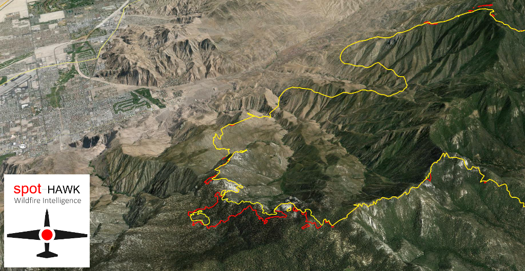
Rate of spread #MountainFire from @Spot_HAWK 2200PDT last night  to 0900PDT this am roughly 0.23-0.46 meters/min
Rate of spread #MountainFire 2200PDT last night to 0900PDT this am roughly 0.23-0.46 meters/min 

Credit:
Long exposure of stars amidst flames of the #MountainFire
Credit: Stuart Palley
MOUNTAIN FIRE PERIMETER MAP 7-19-13 AM
MOUNTAIN FIRE PERIMETER MAP 7-17-13
MOUNTAIN FIRE FROM TORO PEAK WEBCAM  7-17-13
MOUNTAIN FIRE PYROCUMULUS PLUME COLLAPSE 7-17-13


MOUNTAIN FIRE FROM TORO PEAK WEBCAM  7-17-13
MOUNTAIN FIRE FROM TORO PEAK WEBCAM  7-17-13
MOUNTAIN FIRE PYROCUMULUS PLUMES


MOUNTAIN FIRE FROM TORO PEAK WEBCAM  7-17-13
MOUNTAIN FIRE PYROCUMULUS PLUME
MOUNTAIN FIRE OPS MAP
 MOUNTAIN FIRE TOPO MAP
MOUNTAIN FIRE MAP

General Fire Info:
The Mountain Fire started at 1:43 PM on July 15, 2013 near the junction of Highway 243 and Highway 74. It is currently burning east of the Mountain Center and Apple Canyon Areas. It is burning in very steep and rugged terrain in the southern portion of the San Jacinto Wilderness along the Desert Divide and in the Apple Canyon and Bonita Vista Areas.
A Type 1 Incident Management Team has been ordered to assume command of the fire at 1800 hrs on 7/16/2013.


Damage Assessment Update:
Update 7-19:  
Values at risk are 5,600 residences, 56 commercial properties, and 200 outbuildings/others remain threatened. 1 residence was damaged, 7 residences, 5 Commercial buildings and 11 outbuildings were destroyed. 

A damage assessment has been completed for the Bonita Vista, Pine Springs and Zen Mountain Center Area.
Bonita Vista - 3 mobile homes and 3 residences were destroyed, 1 residence sustained damage.
Pine Springs - 1 commercial building, a workshop, garage, and cabin were destroyed.
Zen Mountain Center - No damages.
In addition to the above residences, there was a total of 11 outbuildings and 4-6 vehicles destroyed.

It is important to note that while homes and buildings were destroyed or damaged, firefighters were able to defend and save a larger number of homes.
It is always important to remind homeowners that homes and building with proper clearances and fuels abatements always give firefighters better opportunities to successfully defend and save those homes, especially when defending those homes in the face of an advancing fire front.
MOUNTAIN FIRE: Wednesday afternoon YouTube video update By Bob Poole USFS

Update OSCC 0730 7-30: 27,531 acres, 99% Containment
Update OSCC 0730 7-29: 27,531 acres, 98% Containment
Update OSCC 1900 7-28: 27,531 acres 98% contained.
Update OSCC 0900 7-28: 27,531 acres 98% contained.
Update OSCC 1500 7-27: 27,531 acres 98% contained.
Update OSCC 0900 7-27: 27,531 acres 96% contained.
Update OSCC 1900 7-26: 27,531 acres 92% contained.
San Bernardino N.F. type III organization (Chris Fogle) is in place.
Update OSCC 1900 7-24: 27,531 acres 92% contained.
Update OSCC 1900 7-23: 27,531 acres, 92% Contained
The Incident is in Unified Command with CIIMT3 (Pincha-Tulley), CAL FIRE (Patterson),
A glide path down to transition complete. Coordination between CIIMT#3 and the type 3 team is ongoing to insure a smooth transition. Crews made good progress with direct line construction today. Crews patrolled for hot spots and continue to mop up 200 ft. from perimeter. Suppression repair occurring on in multiple divisions. Transition briefing occurred with type 3 team today at 1600 hrs.
Update 0900 7-24: 27,531 acres, 91%
Update OSCC 1900 7-23: The Fire is in Unified Command between  Pincha-Tulley CIIMT
Team 3 and CAL-Fire ( Glenn Patterson)  27,332 acres, 85 % contained.
Update OSCC 1900 7-22: Mountain Fire CA-BDF-10080
Hwy 243 / Hwy 74 near Idyllwild, Riverside County
The Fire is in Unified Command between USFS ( BDF),
Pincha-Tulley CIIMT Team 3 and CAL-Fire (Glenn Patterson),
and CAL-Fire, and Riverside County Sheriff’s Department
(Lt. Bob Perdue).
 27,332 acres, 85% contained.
Update OSCC 1100 7-21: 27, 279 acres; 68% Contained.
Mountain Fire CA-BDF-10080
Hwy 243 / Hwy 74 near Idyllwild, Riverside County
The Fire is in Unified Command between USFS ( BDF),
Pincha-Tulley CIIMT Team 3 and CAL-Fire (Glenn Patterson),
and CAL-Fire, and Riverside County Sheriff’s Department
(Lt. Bob Perdue).
27,279 acres, 68% contained.
Update OSCC 1100 7-21: Idyllwild, Riverside County,Hwy 243 / Hwy 74 
27,245 Acres, 49% Contained
 The Evacuation Order for the communities of Idyllwild and Fern Valley, and Pine Cove are lifted as of 11:00 AM today. Only local residents and business owners in these affected areas will be allowed to repopulate. No visitors will be allowed into the area until after 11:00 PM.  Residents and business owners need to check-in at one of three Distribution Centers to receive an access pass. The Riverside Sheriff's Department will issue a resident and/or business owner/employee pass, which must be displayed in order to re-enter the evacuated areas. Proper identification will be required. 
 Distribution Centers are located at:
Lake Hemet Market, 56571 State Highway 74, Mountain Center, CA 92561
Banning High School, 100 W. Westward Ave, Banning, CA 92220
Cranston Forest Service Station #54, Highway 74 and Rouse Hill Truck Trail, Hemet, CA
Update OSCC 0800 7-21: 
Idyllwild, Riverside County
Hwy 243 / Hwy 74
27,245 Acres, 49% Contained
 Thunderstorms are currently over the fire area causing erratic winds and downdrafts.  Heavy rain, flash flooding and damaging winds gusting to 55 mph are forecast throughout the day.  Lightning activity Level of 3 increasing to 4 by this afternoon. Isolated areas of the fire have received up to 1.5 inches of rain.  Because of the cloud cover and high relative humidity. Crews made great progress with direct line construction.
 Evacuations of Trails End and Fobes Ranch Road have been lifted.
Update OSCC 1900 7-19:  Mountain Fire CA-BDF-10080
Idyllwild, Riverside County
Hwy 243 / Hwy 74
27,179 Acres, 15% Contained.
The Incident is in Unified Command with CIIMT 3 (Pincha-Tulley), CAL FIRE (Patterson), and Riverside County Sheriff’s Department.  Values at risk are 5,600 residences, 56 commercial properties, and 200 outbuildings/others remain threatened. 1 residence was damaged, 7 residences, 5 Commercial buildings and 11 outbuildings were destroyed. Current critical infrastructure threats include cell sites, radio station, repeater sites, water storage, pumping and treatment facilities, Edison substation and a fire station. 
The fire continues to grow in the Tahquitz Meadow and moving into Long Valley. Extreme fire behavior in the area was held in check by aircraft.
Evacuations Orders (Mandatory) continue for Idyllwild, and Trails End and an evacuation warning for Pine Cove. The Palm Springs aerial tramway was shut down except for emergency use due to fire activity.
Hwy 243 remains closed.
Update OSCC 0800 7-19: Mountain Fire CA-BDF-10080
Hwy 243 / Hwy 74 near Idyllwild, Riverside County
The Fire is in Unified Command between USFS ( BDF),
Pincha-Tulley CIIMT Team 3 and CAL-Fire (Glenn Patterson),
and Riverside County Sheriffs, Department
and CAL-Fire, and Riverside County Sheriff’s Department
(Lt. Bob Perdue).
 24,818 acres, 15% contained.
 The fire has gained a strong foothold in the Taquitz Meadow,
which, is just above and to the east of Idyllwild.
The residential area of Trails End remains threatened with
fire on the ridge above it and continues to expand through the
Aqua Caliente Indian Reservation to the northeast. Thunderstorms
are possible over the fire in the afternoon causing erratic winds,
and downdrafts.
Equipment on-Scene:
3,316 firefighters, including 263 engines, 19 helicopters, 10 fixed wing aircraft, including a DC-10, 53 hand-crews, 30 water-tenders, and 11 dozers.
A Type 1 Incident Management Team lead by Pincha-Tulley assumed command of the fire at 1800 hrs on 7/16/2013. The fire is under Unified Command with CAL FIRE Riverside and Riverside County Sheriff's Office.
Update OSCC 1500 7-18: Mountain Fire CA-BDF-10080
Hwy 243 / Hwy 74 near Idyllwild, Riverside County
The Fire is in Unified Command between USFS ( BDF),
Pincha-Tulley IMT3 and CAL-Fire (Glenn Patterson,
and Riverside County Sheriffs, Department
and CAL-Fire, and Riverside County Sheriff’s Department
(Lt. Bob Perdue).
22,800 Acres, 15% Contained.
 Fire has moved significantly to the north initiating ordered (mandatory) evacuations of Idyllwild. Primary and secondary contingency plans are being developed.
Update 0800 7-18: Mountain Fire CA-BDF-10080
Hwy 243 / Hwy 74 near Idyllwild, Riverside County
22,800 Acres, 15% Contained.
 Mandatory evacuation orders continue for Pine Springs Ranch, Zen Center and Bonita Vista Ranch.  Mandatory evacuation order, now includes Idyllwild and Trails End. The fire is now in unified command with CAL FIRE and Riverside County SheriffsDepartment. The Pacific Crest Trail as well as connecting trails will remain closed until full suppression is achieved . Hwy 243 was reopened to public use this morning. East winds are predicted within the next 24 hrs that will further move the fire to the west and north. 4100 structures continue to be threatened as well as watershed and cultural heritage sites. Primary and secondary contingency planning for the north and south sides, including Idyllwild are being developed. A significant resource assignment into Idyllwild for contingency.
 The expected easterly winds are a major concern for tomorrow's operational period. The fire area is very step with rocky terrain slowing crew access and increasing risk of injuries.
Update 1900 7-17: 19,400 acres, 15% contained
Mountain Fire CA-BDF-10080
Highway 243 / Hwy 74 near Idyllwild, Riverside County
19400 Acres, 15% Contained
Mandatory evacuation orders remain in effect for: Andreas Canyon Club, south of Palm Canyon Drive, Bonita Vista, Pine Springs, and the Zen Mountain Center off of Apple Canyon Road.
Mandatory evacuation orders now in place for Idyllwild and Trails End.
Evacuations of Idyllwild and Fern Valley are being facilitated by Riverside Sheriff’s Office from Saunders Meadow Rd to south of Foster Lake and all streets east and west of Highway 243 are subject to the evacuation order.
Fire has moved to the south into the habitat of the Quino checker spot butterfly
4400 structures are threatened as well as watershed and cultural heritage sites.
Fire is burning in steep rocky inaccessible terrain. A wind shift occurred late this afternoon (7/17) causing the fire to become extremely active.
Smoky conditions with limited visibility are hampering suppression efforts
Update 0800 7-17: OSCC - Mountain Fire CA-BDF-10080
Hwy 243 / Hwy 74 near Idyllwild, Riverside County
14200 Acres, 10% Contained
23 structures lost to date
Previous evacuations remain in effect and numerous campgrounds,
including the Ronald McDonald campground has been evacuated.
Lake Hemet is now is closed to access to all but permanent residents.
Mandatory evacuations were put in place for: Pine Springs Ranch,
Zen Center and Bonita Vista
Incident continues to move towards Palm Springs, Cove-communities 
and Garner Valley.
Structures, watershed, endangered species habit and cultural heritage sites
remain threatened.
If fire changes direction a larger structural threat will exist.
Fire is burning in steep-rocky inaccessible terrain.
Hwy 243 closed at Mountain Center
Pacific Crest Trail is closed and all connecting trails to PCT closed as well.
Update 1500 7-16: OSCC - Mountain Fire CA-BDF-10080 Hwy 243 / Hwy 74 near Idyllwild, Riverside County
9000 Acres, 10% Contained 19 structures lost to date
Evacuations remain in effect.
Incident is currently moving towards Palm Springs and cove communities.
Structures, watershed and cultural heritage sites remain threatened. If fire changes direction a larger structural threat will exist. Fire is burning in steep inaccessible terrain and amongst bug-kill timber.
Pincha-Tulley IMT3 assumed command at 1800 hours today (7/16).
Update 1100 7-16: 8000 Acres, California IMT Team 3 is being activated for the Mountain fire 
Update 0800 7-16: OSCC - Mountain Fire CA-BDF-10067
As of 0900 hours the Mountain fire’s incident number has changed from CA-BDF-10067 to CA-BDF-10080
Riverside County
4700 acres 10% contained
Multiple structures lost
Evacuations are still in effect
Structures Threatened
Livestock threatened
Hwy 243 closed
Pacific Crest Trail closed
Update 1900: OSCC - Mountain Fire CA-RRU-71832/CA-BDF-10067
Riverside County
Location: Hwy 243 / Hwy 74 Mountain center
1,000 acres, 5% contained,
Structures reported burned in the Pine Springs Ranch area.
Type  2 Team cancelled, Type 1 team ordered
Update 1845:  1000 acres with 5% containment. A large and small animal shelter has been opened at the San Jacinto Animal Shelter at 581 South Grand Avenue in San Jacinto (951) 358-7387
Update 1830: OSCC - Mountain Fire CA-RRU-71832/CA-BDF-10067
Riverside County
Location: Hwy 243 / Hwy 74 Mountain center
400 Acres, 0% Contained 
Evacuations are in effect for Bonita Vista and Apple Canyon. 
Bonita Vista and Apple Canyon Structure Threat
Unified command with BDF with RRU as ordering point for now. Type 2 Fed team ordered; in briefing tonight (7/15) at 2200 hours with transition occurring tomorrow 7/16/13 at 0600 hrs.
Evacuation center is located at Hemet High School.
Update 1645:  300 acres 5%, MANDATORY EVACUATIONS - HUGE RESOURCE ORDERS 13 CREWS 1 HELITENDER , 5 DOZERS, 8 TYPE 3  ST , 500 LUNCHES IC request type 2 IMT Resource orders 6 Type 3 ST 5 Type 2 Dozers 13 Type 1 Crews 1 Helitanker 
Update 1630: Evacuating camp off Apple Valley Rd. AA ordered 2 helitankers immediate need for structure threat. Will take whatever is available if he can not get helitankers. Update 1620: 150+ acres 0% containment, Fire has crested Vista Bonita Road and is threatening structures in the Apple Canyon area
Update 1500: 100+ acres 0% containment, spotting ahead of the fire. Air Attack Requested 2 additional Type 3 air tankers

View from Hemet Ca  Credit: Erin ‏@chickenpotpie83m
pic.twitter.com/B58Fn6BpLs
Update 1430:  now estimated at 30 acres, medium vegetation and light winds per Air Attack.

Road Closures: Highway 243 closedSouthbound Highway 243 is closed at Mountain Center and above Keenwild. 
Location: Highway 243 at Mountain Center. Riverside County 
Reported Date/time: 1:43 PM
IA: 5 acres
ROS: Moderate
ROC: CAL FIRE/Riverside County Firefighters along with the US Forest Service are on-scene of wildland fire in Mountain Center. First arriving units reported approximately five acres burning in heavy fuels at a moderate rate. Potential for 500 acres
Structure Threats: *
Concerns: *
Resources: 1700hrs - Resource orders 6 Type 3 ST 5 Type 2 Dozers 13 Type 1 Crews 1 Helitanker 
Fire Fighters: 80
Helicopters: 4 
Engine Companies: 13
Bulldozers: 2
Water Tenders: 1 
Air Tankers: 4 
Air Attack: Yes
Truck Companies: 0

Fire Crews: 2 
OES: No
Overhead Personnel: 3 

Red Cross: No
Fire Investigator: No 
Cooperating Agencies: CAL FIRE/Riverside, California Highway Patrol – Indio, Riverside County Fire Department, Riverside County Sheriff’s Office, USFS – San Bernardino,
Weather Info: KEENWILD  RAWS 
http://raws.wrh.noaa.gov/cgi-bin/roman/meso_base.cgi?stn=KNWC1
Special Conditions: *
Other Comments: *
Radio Frequencies: *
Agency Website: Riverside County Incident Page - http://www.rvcfire.org/
Live Video: *
---------------------------------------------