California Statewide Fire Summary
Tuesday, August 27, 2013
Today over 9,300 CAL FIRE, local and federal firefighters are on the frontlines
battling 10 active major wildfires across California.
Tuesday, August 27, 2013
Today over 9,300 CAL FIRE, local and federal firefighters are on the frontlines
battling 10 active major wildfires across California.
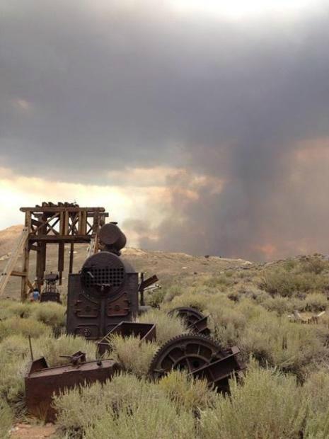
Full containment on the Spring Peak Fire that burned into California near Bodie State Park in Mono County.

#SpringPeakFire, #FINAL NE of Mono Lake CA, FRA 14,200 acres 100% contained. -* No Damage In Town of Bodie *- #NvFire #CaFire

Rim Fire’s continues growth near Yosemite National Park and historic gold country towns of California, this morning becoming the 7th largest wildfire in California’s recorded history.
**CAL FIRE Incidents**
Deer Fire, Tehama County
10 miles east of Los Molinos
* 10,378 acres – 75% contained
* Full containment expected on Thursday, 8/29
**Unified Command Fires**
Rim Fire ,Tuolumne County Stanislaus National Forest/CAL FIRE
* northeast of Groveland
* 179,481 acres - 20% contained
* Evacuations in effect
* 4,500 residences threatened
**Federal Fires** American Fire, Placer County US Forest Service – Tahoe National Forest
northeast of Foresthill
* 24,935 acres - 88% contained
* CAL FIRE is assisting
Fish Fire, Tulare County US Forest Service – Sequoia National Forest
25 miles northeast of Springville
* 1,900 acres - 7% contained
Little Fire, Riverside County US Forest Service – San Bernardino National Forest
Off Hwy 74 near Lake Hemet
* 100 acres - 70% contained
Gobblers Fire, San Bernardino County US Forest Service – San Bernardino National Forest
6 miles south of Wrightwood
* 413 acres - 93% contained
Spring Peak Fire, Mono County FINAL US Forest Service – Humboldt-Toiyabe National Forest 15 miles northeast of Mono Lake
* 14,200 acres - 100% contained
* The fire is primarily in Nevada but did burn into California near Bodie State Park
Orleans Complex, Siskiyou County
US Forest Service – Six Rivers National Forest, 6 miles southeast of Somes Bar
* 21,188 acres - 45% contained
Corral Complex, Humboldt County US Forest Service – Six Rivers National Forest,
east of the Hoopa Indian Reservation
* 11,732 acres - 5% contained
Salmon River Complex, Siskiyou County US Forest Service – Klamath National Forest, 1 mile west of Sawyers Bar
- 3,700 firefighters
- 4,500 homes threatened remained threatened along the Hwy 108 corridor in Tuolumne County.
- Majority of the large wildfires are burning on federal land, CAL FIRE and local fire
departments continue to support the US Forest Service in their battle.
Weather: A low pressure system off the coast could bring some moisture along the Sierra, however most areas in Northern California could continue to see southwest winds. If the weather system moves onshore, it could bring some unseasonably cool conditions, which help aid firefighters in their containment efforts.
In Southern California rainfall is likely to continue over the mountains and deserts.
. Todays Major Fires of Interest:
. Todays Major Fires of Interest:
**CAL FIRE Incidents**
Deer Fire, Tehama County
10 miles east of Los Molinos
* 10,378 acres – 75% contained
* Full containment expected on Thursday, 8/29
**Unified Command Fires**
Rim Fire ,Tuolumne County Stanislaus National Forest/CAL FIRE
* northeast of Groveland
* 179,481 acres - 20% contained
* Evacuations in effect
* 4,500 residences threatened
**Federal Fires** American Fire, Placer County US Forest Service – Tahoe National Forest
northeast of Foresthill
* 24,935 acres - 88% contained
* CAL FIRE is assisting
Fish Fire, Tulare County US Forest Service – Sequoia National Forest
25 miles northeast of Springville
* 1,900 acres - 7% contained
Little Fire, Riverside County US Forest Service – San Bernardino National Forest
Off Hwy 74 near Lake Hemet
* 100 acres - 70% contained
Gobblers Fire, San Bernardino County US Forest Service – San Bernardino National Forest
6 miles south of Wrightwood
* 413 acres - 93% contained
Spring Peak Fire, Mono County FINAL US Forest Service – Humboldt-Toiyabe National Forest 15 miles northeast of Mono Lake
* 14,200 acres - 100% contained
* The fire is primarily in Nevada but did burn into California near Bodie State Park
Orleans Complex, Siskiyou County
US Forest Service – Six Rivers National Forest, 6 miles southeast of Somes Bar
* 21,188 acres - 45% contained
Corral Complex, Humboldt County US Forest Service – Six Rivers National Forest,
east of the Hoopa Indian Reservation
* 11,732 acres - 5% contained
Salmon River Complex, Siskiyou County US Forest Service – Klamath National Forest, 1 mile west of Sawyers Bar
* 14,771 acres - 95% contained
Aspen Fire, Fresno County US Forest Service – Sierra National Forest near Huntington Lake
* 22,791 acres - 95% contained
For the latest on the fires visit CAL FIRE NEWS
Aspen Fire, Fresno County US Forest Service – Sierra National Forest near Huntington Lake
* 22,791 acres - 95% contained
For the latest on the fires visit CAL FIRE NEWS
---------------------------------------------