Showing posts with label Wildland Fire. Show all posts

CA-SQF-Angora Wildland fire, 134 acres 100% contained. [FINAL] T-3 Sanders, Golden Trout Wilderness, Sequoia N.F. #CaFire

Angora Fire CA-SQF Angora Fire CA-SQF-003627 Angora Mountain Tulare County

A new wildland fire called the Angora Fire was discovered around noon on Sunday September 8th burning in the Golden Trout Wilderness in Sequoia National Forest. The Angora Fire has now reached an estimated 150 acres and is burning towards the ridge top near Angora Mountain.

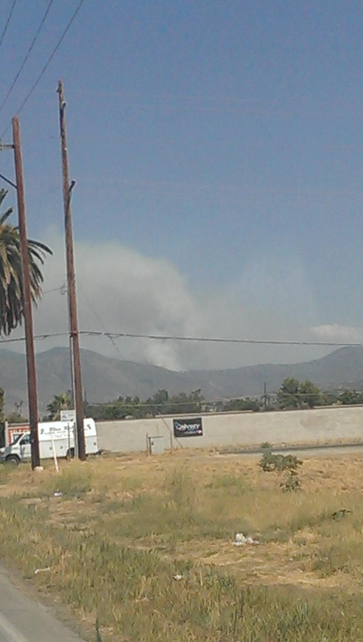
Smoke may be visible from the surrounding communities throughout the day and is likely to settle into the valleys overnight and in the morning hours. Information on air quality and measures you can take at home to reduce your exposure to smoke can be found on http://www.valleyair.org/Home.htm for the San Joaquin Valley Air Pollution Control District or http://www.gbuapcd.org/ for the Great Basin Unified Air Pollution Control District.

Resources: Two hotshot crews Springville and Fulton along with 10 smokejumpers out of the Porterville Air Attack base are working to fully suppress the fire Sunday night. An additional two hotshot crews Kern Valley and Horseshoe Meadow will be flown into the fire first thing Monday morning. Helicopters from Kernville and Peppermint are shuttling crews to the fire which is burning in the backcountry where there is no road access. 

An Air Attack plane is directing six Air Tankers in dropping retardant to help slow the spread of the fire while crews on the ground construct fire line in an effort to contain it. The cause of the Angora Fire is believed to be lightning.

Closures: Forest officials anticipate the need to close the Deep Creek Trail (32E05) east of Lion Meadow travelling north to Coyote Peaks due to the Angora Fire. Additional trail closures may be put in place if this Fire continues to spread. Backcountry travelers planning a trip into the Golden Trout Wilderness should contact the Western Divide Ranger District 559-539-2607 Monday through Friday 8 a.m. – 4:30 p.m. for latest fire and trail closure information prior to travel.

The area closure put in place during the Fish Fire was mostly re-opened late Friday except Trail 33E14 the Willow Meadow cutoff trail which remains closed. Travelers need to stay on the trails near the Fish Fire area for their safety. There are still hot spots smoldering in the burned area trees that may fall having been weakened by fire and rolling debris loosened from burned vegetation.

Update 9-14-13 1800: 134 acres 100% contained
This will be the final report on this incident. Type 3 Incident Sanders 

Update 9-14-13 0800: 255,858 acres, 80% contained
Resources will continue to patrol, mop-up, and monitor all areas of the fire perimeter. Implementation of the Suppression Repair Plan will continue.
Update 9-13-13 0800: 134 acres 85% contained, Type 3 Incident Sanders 
Crews are starting to get more depth during mop-up operations. 
Plan is to continue to construct direct handline and hold and improve line which is already completed.
Update 9-12-13 1800: Update 9-12-13 0800: 134 acres 85% containment.Type 3 Incident Sanders
Update 9-12-13 0800: 150 acres 70% contained, Type 3 Incident Sanders .
Update 9-11-13 0800: 150 acres 70% contained, Type 3 Incident Sanders .
Update 9-10-13 0800: 111 acres 20% containment Isolated torching, fire growth was minimal; most of the fuel consumption was from spots burning together. Continue handline construction with aircraft support.
Update 9-9-13 1800: 111 acres 20% containment, Type 3 Incident Sanders
Crews continued direct line construction up both flanks, had a 2 acre slop-over on east side of fire. Plan is to insert two more Type 1 crews in the morning to continue hand line construction with aircraft support.

Basic Information
Incident Type: Wildfire
Cause: Lightning
Location: Golden Trout Wilderness, Sequoia National Forest
Incident Commander: David Ernst

Current Situation
Total Personnel - 80
Size - 150 acres
Outlook/Remarks - Golden Trout Wilderness, no road access, Fire is burning out in the Wilderness and does not pose a threat to campgrounds or roads most often travelled by visitors. 
---------------------------------------------

LODD: 19 YEAR OLD FIREFIGHTER DIES IN THE LINE OF DUTY-APPARATUS CRASH AT WILDLAND FIRE


We regret to advise you that around 0830 yesterday, 19-year-old Jesse Trader was killed Tuesday morning while working the Big Windy Complex Fire about 25 miles northwest of Grants Pass in Josephine County Oregon.

Initial reports are that he lost control of the water tender/tanker vehicle he was driving, down a hill, lost control and went over the edge of a cliff. Rescue medics arrived within minutes but he could not be saved.

Jessie was a contractor FF was operating in the area of the big windy complex fire (one of five major forest fires in the region) was killed in the Line of Duty in a truck crash

Sheriff Gil Gilbertson says Trader was driving a water truck around 7:20 a.m. along Bear Camp Road near Soldier Camp when he lost control and slammed into an embankment. Gibertson estimates he might have been going 30 to 40 mph at the time of the accident. Life Flight got to him right away but it was too late. Trader was coming off his overnight shift.

He was a 2012 graduate of West Albany High School.

The southwestern fires were ignited by lightning late last month. They are burning in some of the state's most difficult mountain terrain, fed by vegetation parched by a widespread drought.

Our condolences to all-RIP


Related story: 

Water Truck Driver Killed During Oregon Wildfire

Driver was returning truck used at Big Windy fires when crash occurredPORTLAND, Ore. (AP) — The death of a 19-year-old water truck driver outside a rural Oregon wildfire came just months after he joined a community college firefighter training program and readied for his first fire season.

Jesse Trader had a baseball scholarship to Western Oregon University but chose to enroll at Chemeketa Community College for its fire protection program instead, his mother said Tuesday.

"This is what Jesse wanted to do with his life," said Gigi Trader, of Albany.

Jesse Trader was killed when his water truck overturned on a rural road's embankment early Tuesday morning outside the Big Windy complex of fires in southwest Oregon. Trader was taken from the scene by an air ambulance, but emergency responders were unable to revive him.

He was the sole occupant of the truck.

Gov. John Kitzhaber said in a prepared statement that Oregon owes Trader a debt.

"Even at such a young age, he was already contributing mightily to his community," Kitzhaber said, "and we owe him our gratitude for his commitment to helping protect his fellow citizens."

Trader's mother said his faith, and hers, helped her cope with the reality of his death just hours after getting a call from law enforcement.

"He was always willing to share his faith with others, he never got in any trouble," Gigi Trader said. "He was somebody who was going to be very successful."

Josephine County Sheriff Gil Gilbertson said it was unclear from the crash site why the truck left the road and overturned. "He was coming down the hill," Gilbertson said. "(The truck) was heading down to get a relief driver."

Trader was the second crew member killed this wildfire season in Oregon, and the 29th nationally.

On Aug. 1, 58-year-old John Hammack was killed in Central Oregon when the tree he was cutting fell on him.

The southwestern fires were ignited by lightning late last month. They are burning in some of the state's most difficult mountain terrain, fed by vegetation parched by a widespread drought.

The Big Windy's three fires are burning northwest of Grants Pass. More than 1,100 personnel were assigned to it as of Tuesday morning, and the fire area is estimated at more than 14 square miles, or more than 9,100 acres.

Fire officials hope to have containment lines around it next month but some say it could grow much larger and burn until fall rains and snow put it out.

"We're going to live with these fires until October 15th or later," Dan Thorpe, forester in charge of the state Department of Forestry's southwest district who has seen 41 fire seasons, said in an interview published Tuesday in the Medford Mail Tribune (http://bit.ly/12Y3I1Q ).

The fire is in the Siskiyous, a range that's part of the Klamath Mountains straddling southwest Oregon and Northern California.

There are six major wildfires in Oregon as of Tuesday. One of the southwestern fires, named Brimstone, is now considered 100 percent contained. The rest of the southwestern fires are burning on nearly 60,000 acres, or more than 93 square miles, and have drawn more than 5,600 people to fight them.

The sixth fire, in Central Oregon, has about 450 people working on the fire and is burning on about 500 acres.

Associated Press writer Tim Fought contributed to this report.

Copyright 2013 The Associated Press.
---------------------------------------------

CA-SRF-Butler Fire 21,105 acres, 39% contained.Expected containment: 09/15/13.NIMO.(Quisenberry). [MAP] #CaFire.

CA-SRF-Butler Fire Wildland Fire

As of August 25, 2013 at 6:00pm, the Siskiyou County Sheriff’s Department has lifted the Evacuation Advisory for the Sawyers Bar, Idlewild, and MuleBridge area.
 The Evacuation Advisory for the area along State Highway 93 (Salmon River Road) between Butler Flat and Forks of Salmon has also been lifted.
Roads:  North Fork/Sawyers Bar Road is open to the public although motorists are urged to drive with extreme caution. Highway 93 between Forks of Salmon and Somes Bar is open to the public with one-way controlled traffic. Motorist should expect delays at times and this road is also subject to temporary closures as conditions dictate.

Evacuation advisory posted includes the Forks of Salmon community. Point protection of structures in the fire area is continuing. Expansion of the structure defense corridor has been moved south as needed along the Salmon River Road.

Update 9/1 0900:  ALL FURTHER UPDATES AT FORKS COMPLEX http://calfire.blogspot.com/2013/09/ca-knf-forks-complex-includes-ca-srf.html
 NOW includes CA-SRF- & CA-KNF- 36,146 acres, 45% contained. 

Update 8/26 0900:  21,105 acres, 39% contained.  Expected containment: 09/15/2013. Quesinberry, NIMO. A marine layer kept overnight fire behavior to a minimum with creeping and smoldering within interior pockets. A strategic operations plan has been developed that identifies management action points and modeled fire behavior. Strategic operations plan report points to a long term fire event as the fire burns within indirect containment lines.
Update 8/25 1900:  21,105 acres, 39% contained. Expected containment 09/15/2013. IMT 1 (Quesinberry). Rain overnight reduced fire behavior to creeping and smoldering throughout much of the day. Some heat was observed in the interior portions of the fire as heavier fuels continued to consume. Portions of the fire received up to 1/2 inch of rain overnight and some showers through the day
Update 8/25 0900:  20,770 acres, 39% contained. Expected containment 09/15/2013. IMT 1 (Quesinberry). Burn operations in the early portion of the operational period were successful. A moist front moving into the fire area kept fire behavior limited to creeping and smoldering in the latter half of the period. Good progress was made on the west side of the fire south of Orleans Mountain Lookout to secure the line with ground and aerial ignition operations. A Forest issued area closure is in effect that incorporates the fire. A Red Flag Warning has been issued for the fire area for possible thunderstorm activity through 1700 8/25.
Update 8/23 1900: 20,596 acres, 39% contained. Expected containment 9/15/2013. NIMO (Quisenberry). A marine layer limited fire behavior during the morning hours. Once the layer receded, the fire became active moving along interior edges and interior islands. Firefighters continued to mopping up the spot fire and slopover south of Orleans Mountain. Burning operations were conducted in this area to secure a short portion of the line and close the gap. Firefighters continue monitor the fire as it moves towards indirect containment lines on the southern portion of the fire.
Update 8/23 0900: 20,496 acres, 35% contained. Expected containment 9/15/2013. NIMO (Quesinberry). Fire behavior was minimal through the night as RH recovery was influenced by a deep marine layer push into the drainages. The spot fire south of Orleans Mountain was held to 12 acres. The fire continues to spread to indirect containment lines. Firefighters continue to prep and burn out as necessary to keep fire within indirect containment lines.
Update 8/22 0900: 19,538 acres, 35% contained. Expected containment 9/15/2013. NIMO (Quisenberry). Fire behavior was moderated by measureable precipitation from passing thunderstorms. Fire continues to spread towards indirect containment lines. Spot fire has been contained and mop up will continue today to secure. Salmon River Road remains closed to public use.
Update 8/21 1900: 19,538 acres, 35% contained. Expected containment 9/15/2013. NIMO (Quisenberry). Cloud cover moderated fire behavior during first part of operational period, but thunderstorms created outflow winds that increased fire behavior later in the shift. Some measurable precipitation occurred. A spot fire was reported by night shift south of Orleans Mountain and day shift resources made good progress to contain the spot.
Update 8/21 0900: 18,361 acres, 30% contained. Expected containment 9/15/2013. NIMO (Quisenberry). Fire burned actively through the night with some spotting issues early in the operational period. Line construction continues on Cold Spring Road. Indirect fireline on Hoteling Ridge continues to be prepared for firing operations. Mop and patrol continues on secured firelines.
Update 8/20 1900: 18,361 acres, 30% contained. Expected containment 9/15/2013. Quisenberry, NIMO. Active fire behavior occurred today after the inversion lifted at 1130 hours. Surface fire runs with isolated single tree torching produced spot fires 1/4 mile. Smoke shaded the western half of the fire today, keeping fire behavior to a moderate surface fire.
Update 8/20 0900: 18,361 acres, 30% contained. Expected containment 9/15/2013. Quisenberry, NIMO. An inversion settled in to the drainage bottoms at sunset, minimizing fire behavior. Ridge tops remained clear and fire behavior was active for the first half of last night's operational shift. A dry unstable air mass is over the fire area and increased fire behavior is predicted today.
Update 8/19 0900: 16,776 acres, 25% contained. Quesinberry, NIMO. Estimated containment: 09/15/2013. Minimal fire activity was observed throughout the night. Approximately 1 mile of burning was completed. A strategic operations plan has been developed that identifies management action points and modeled fire behavior. Strategic operations plan report points to a long term fire event as the fire burns within indirect containment lines.
Update 8/18 1900: 15,900 acres, 25% contained. Quesinberry, NIMO. Estimated containment: 09/15/2013. Increased fire activity during last half of operational period resulted in active flanking and forward spread up to 1/4 mile. Voluntary evacuation remains in effect for isolated residences near the community of Forks of Salmon. The Salmon River Road remains closed to public use in the fire area. Expansion of the structure defense corridor is being moved south as needed along the Hwy 93 corridor and areas in and around Know-nothing Creek drainage.
Update 8/18 0900: 15,878 acres, 25% contained. Quesinberry, NIMO. Estimated containment: 09/15/2013. Increased fire activity during last half of operational period resulting in active flanking and forward spread up to ¼ mile.
CA-SRF-Butler Fire Wildland Fire
CA-SRF-Butler Fire Wildland Fire
Update 8/17 0900: 14,869 acres, 24% contained. Estimated containment 9/15/2013. Command has been transitioned to Incident Commander Quesinberry - NIMO. Minimal fire activity was observed throughout the night. In lower drainages, higher humidity limited fire spread to smoldering and creeping and isolated jackpots burning in heavy fuels. Dry fuels continue to be receptive to spot fires during the burning period; spotting has been observed quarter to half mile ahead of the main fire.
Update 8/16 0900: 14,723 acres, 24% contained. The fire made runs northwest towards the ridge top above Butler Creek. Firing operations continued to contain the fire at the ridge. Point protection of structures in the fire area is continuing. Expansion of the structure defense corridor has been moved south as needed along the Salmon River Road.
Update 8/15 1900: 13,388 acres, 22% contained. Poor RH recovery at higher elevations provided active fire behavior throughout last night's operational period. This lead to isolated single and group tree torching and active flanking on the fire's edge. Lower drainages had higher humidity recovery and fire spread was limited to creeping and smoldering. Point protection of structures in the fire area continues. Salmon River Road remains closed to the public use in the fire area.
Update 8/14 1900: 12,100 acres, 22% contained.  Estimated containment, 09/15/2013. Dry fuels continue to be receptive to spot fires during the burning period. Spotting has been observed one quarter to one half mile ahead of the main fire. Large fuels burning under canopy are preconditioning fuels for short crown runs. Air operations are limited due to smoke inversion that lifts late in the afternoon. Smoke from nearby fires is settling in around the Butler Fire, impacting air quality and visibility.
Update 8/13 1900: 10,590 acres, 22% contained.  Estimated containment: 09/15/2013. Due to the slop overs in Division B, a decision point was reached resulting in an evacuation advisory for the community of the Forks of Salmon.  Day resources continued to evaluate opportunities to contain slop overs in McNeal Creek.  Poor visibility snags, and steep terrain hampered containment efforts along the line.  Point protection of structures in the fire area continues and will expand south as needed along the Hwy 93 corridor.
Update 8/13 0900:  10,270 acres, 20% contained. The Salmon River Road remains closed to public use in the fire area. The North Coast Unified Air Quality Management District and Siskiyou County Air Resource Board have issued air quality and health advisories in both Humboldt and Siskiyou Counties. An evacuation advisory remains in effect for residences along HWY 93 from Butler Flat to north of the Forks of Salmon. The new evacuation advisory posted last night includes the Forks of Salmon community. Steep terrain, rolling material, snags and inaccessible areas hamper the ability to construct direct line construction.
Update 8/12 1900:  9,580 acres, 20% contained. Steep terrain, rolling material, snags and inaccessible areas hamper the ability to construct direct line construction. Dry fuels continue to be receptive to spot fires; spotting has been observed quarter to half mile ahead of the main fire. Air operations are limited due to smoke inversion that lifts late in the afternoon.
Update 8/10 0900: 8,204 acres, 14% contained. Structure protection continues in Butler Flat, Nordheimer and other structures along the Salmon River Road. Good progress continues on indirect control lines. Road crews opened HWY 93 to fire traffic only, relieving some logistical problems. Fire continues to flank and spread laterally into Butler, Lewis, Hammel and Nordheimer Creeks, however slow rates of spread were observed due to cooler weather and higher humidity. Good progress continues on indirect control lines.
Update 8/9 1900:  7,845 acres, 14% contained. Fire continues to flank and spread laterally into Butler, Lewis, Hammel and Nordheimer Creeks, however slow rates of spread were observed due to cooler weather and higher humidity. Good progress continues on indirect control lines. Mop up continues around structures at Butler Flat, Nordheimer and other structures along the Salmon River Road. Salmon River Road remains closed, but road crews were able to open the road to fire traffic only, relieving logistical problems.
Update 8/9 0900:  7,498 acres, 8% contained. Short range spotting is occurring across narrow canyons. Smoke inversion continues to impact air operations during the burning period. The spot fire detected yesterday on the northeast side of the Salmon River has been lined and contained. Good progress continues on indirect control lines.
Update 8/8 1600:  6,305 acres, 8% contained. The fire continues to back in to Hammel, Butler, Lewis and Nordheimer Creeks. Snags are present from previous fires, contributing to increase in time needed to prep lines for firing operations. Road closures continue on Salmon River Road. Power and water systems in Butler Flat have been affected by rock fall.
Update 8/8 0600:  6,248 acres, 8 % contained. Fire continues to spread into Hammel and Butler Creeks. Fire has spotted into Nordheimer Creek drainage.
Update 8/7 0600:  4,852 acres, 8% contained. Fire continued to back downslope with roll out creating spot fires downslope of the main fire. Isolated torching was observed today with continued surface fire activity around uncontrolled fireline.
Update 8/6 1600:  4,007 acres, 4% contained. Fire will continue to spread in all directions until checked by completed containment lines. Hotter and dryer conditions will begin to dissipate tonight as instability moves into the area giving way to cooler temperatures and higher relative humidity.
Update 8/6 0600: 2,800 acres 5% contained.
Update 8/5 0600: 2,449 acres 5% contained.
ButlerCA-SRF-001388Type: WFStart: 07/31/2013 2052Cause: UPriority:
Overhead Team Name: Matt JohnsonOrganization: Type 2 TeamLocal:GACC:
Size:
950 ACRES
% Cnt/MMA:
3 %
Est Contain:
NR
Latitude:
41° 20´ 0"
Longitude:
123° 22´ 32"
Location: 10 miles east of Somes Bar$$ Costs to Date: $1,400,000
Structures Threatened: 10 OUTB , 21 PRIMStructures Destroyed: NONE
Resources Committed:Total Personnel: 505Report Date: Aug 04, 2013 0600
AgencyCRW1CRW2HEL1HEL2HEL3ENGSOVHD
BIA0000002
FWS0000001
LGR00000122
NPS0000002
PRI04201010
ST60000108
USFS811311420
Significant Events: The fire continued to back into Grant and Lewis Creek drainages, consuming more of the bottom of Lewis Creek drainage. Structure defense and preparation continued on residences along the river east to Nordheimer and initiated on structures within the Nordheimer Creek drainage. Point protection was initiated around structures where needed throughout the night. Drop point 9 has been closed along with the adjacent portion of Hwy 93 to Grant Creek drainage due to frequent roll out and rock fall.
Remarks: A road closure continues on Hwy 93 from Oak Bottom campground to Nordheimer Flat. The North Coast Unified Air Quality Management District issued a health advisory for the communities of Hoopa, Willow Creek, Orleans, Forks of Salmon, Burnt Ranch, and Karuk Tribe. Preparations are being made to move ICP from Hoopa to Aikens Camp.
Observed Fire Behavior: The fire activity remained moderated due to good overnight humidity recovery. Roll out continued to occur within the Lewis and Grant Creek drainages initiating the potential for short runs during the burning period.
Planned Actions: Provide point protection for structures along Hwy 93 corridor and within the Nordheimer Creek drainage. In Division A/E, construct line along Nordheimer Ridge from DP1 to DP3. In Division H/K/T construct control and re-establish old control lines from the 2006 Somes Fire and 1977 Hog Fire. In Division W/Z provide for structure defense, point protection and construct control line from DP8 to forest road 11N09.

Update 8/4 0600: 950 acres 3% containedUpdate 8/3 1600 945 acres 3% contained. At risk are residential structures in Butler Flat, along the Salmon RIver Road to Nordheimer Campground along Nordheimer Creek, culturally sensitive areas fish & endangered wildlife habitat, and the Salmon River watershed.
Update 8/3 0900 851 acres, 0% contained. Smoke inversions are limiting air operations until late in the day.
Update 8/2 0900: 400 acres, 0% contained. Residential structures in Butler Flat and along river corridor remained threatened. Salmon River road remains closed.
Update 1800: 400 acres, 0% containment. Salmon River Road remains closed. NORCAL Team 2 assumed command at 1800 hours
Update 1600: 250 acres, 0% contained, multiple spot fires. Fire has spotted across Salmon River and established in Morehouse Creek. Salmon River Road closed.
Update 1300: Highway 93 is currently closed approximately 10 miles east of Somes Bar due to the Butler Fire.

Location:  Six Rivers National Forest Near Forks of Salmon.

---------------------------------------------

CA-MCP-? Range Fire Camp Pendleton #WildlandFire 230+ acres, Forward progress stopped.


Camp Pendleton Firefighters kept busy yesterday when a vegetation fire broke in Fire Station 28’s first due. 
The fire in the Case Springs area consumed more than 230 acres. 
No injuries were reported or structures threatened. 
---------------------------------------------

CA-LNU-Spring Fire Wildland Fire 3 acres, Rapid ROS Clearlake, Lake County

CA-LNU-Spring - Lake County 

Update 1515: Air Attack released.
Update 1330: Fire on both sides of New Long Valley Road, Fire has jumped Cache Creek.

Location: Pomo Trail and New Long Valley Rd, Clearlake, CA
Acres: 3
ROS: Rapid
ROC: Fire on both sides of New Long Valley Road. Fire has jumped Cache Creek.
Structure threat: Yes
Special Hazards:
Concerns: *
Resources:Engines: 1418, 1498, 1473, 1456, 1488, 1458, MNF 45, MNF 42,
Dozers:  D1444, D1448
Crews: Kon 1, Kon 2, Kon 4, Kon 5
Aircraft: H-104
T90, T91, T83, AA110
Radio Frequencies: LNU East, and V Fire 22
Weather Info: Thursday, 18 95 | 50 °F Clear Chance of Precipitation 0% Friday, 19 97 | 52 °F Clear Chance of Precipitation 0% Saturday, 20 99 | 55 °F Clear Chance of Precipitation
Maps: http://tinyurl.com/lljqakr
Agency Website: calfire.ca.gov
Online Scanner: http://www.broadcastify.com/listen/feed/2645/web
Web Cams: *
---------------------------------------------

#MountainFire #WildlandFire CA-BDF-10080 27,531 acres 100% contained. This will be the final report on this incident.

CA-RRU-71832 - CAL FIRE Riverside County Wildland Fire
27,531 acres 100% contained. This will be the final report on this incident.

A Type 1 Incident Management Team lead by Pincha-Tulley assumed command of the fire at 1800 hrs on 7/16/2013. The fire is under Unified Command with CAL FIRE Riverside and Riverside County Sheriff's Office.

Incident Overview

The Mountain Fire started at 1:43 PM on July 15, 2013 near the junction of Highway 243 and Highway 74. It burned east of Mountain Center, through the Apple Canyon and Bonita Vista areas, and then along the Desert Divide and southern portion of the San Jacinto Wilderness.
Fire crews continue to improve fireline and are extinguishing hot areas close to the fire’s edge. Residents and visitors may still see smoke towards the north end of the fire, due to the heavy fuels within the perimeter of the fire.
A Burned Area Emergency Response Team (BAER) is now conducting a rapid assessment of the fire area. The BAER team will assess the fire damage and determine if immediate actions are necessary. Actions may include work to help stabilize soil; control water, sediment and debris movement; prevent impairment of ecosystems; mitigate significant threats to health, safety, life property and downstream values at risk.
The San Bernardino National Forest has assumed command of the fire from California Incident Management Team 3 and continues to work closely with all the local agencies in the Idyllwild and Palm Springs area.
Weather
The National Weather Service has issued a Flash Flood Watch from 11:00 am this morning until later this evening. Increasing monsoonal moisture will increase the potential for flash flooding from scattered thunderstorms in the mountains and deserts. Recent burn areas will be more prone to flash flood and mud and debris flows from the thunderstorms.
Notices
Open:
The Communities of: Idyllwild, Fern Valley, Pine Cove, Bonita Vista, Pine Springs, and Trails End
Palm Springs Aerial Tram
Hurkey Creek Campground has reopened for Camping Only Hiking and Biking Trails Remain Closed.
Idyllwild State Park and Stone Creek State Park
Lake Hemet Campground
Highway 243
Highway 74
Closed:
All Forest Service Campground and Day-use areas located along Highway 243, Including Lake Fulmor, Black Mtn. Group Camp, Boulder Basin CG, Dark Canyon CG, Fern Basin CG, and Marion Mtn CG. Trail closures include Devils Slide, South Ridge, Deer Springs, Marion Mountain, 7 Pines, Black Mountain, and Fuller Ridge,trails, the Pacific Crest trail from Highway 74 (mile 152) to Strawberry Junction (mile 183) and all trails connecting to the Pacific Crest Trail, including: South Ridge, Carumba, Spitler Peak, Fobes, and Cedar Springs Trail.
San Bernardino National Forest Closure Orders 13-8 and 13-9 north of Highway 74 and east of Highway 243
San Jacinto Wilderness
San Jacinto State Park Wilderness.
All hiking and mountain biking trails out of Hurkey Creek County Campground Area / May Valley Area..


MOUNTAIN FIRE PERIMETER MAP 7-19-13 AM
Rate of spread #MountainFire from @Spot_HAWK 2200PDT last night  to 0900PDT this am roughly 0.23-0.46 meters/min
Rate of spread #MountainFire 2200PDT last night to 0900PDT this am roughly 0.23-0.46 meters/min 

Credit:
Long exposure of stars amidst flames of the #MountainFire
Credit: Stuart Palley
MOUNTAIN FIRE PERIMETER MAP 7-19-13 AM
MOUNTAIN FIRE PERIMETER MAP 7-17-13
MOUNTAIN FIRE FROM TORO PEAK WEBCAM  7-17-13
MOUNTAIN FIRE PYROCUMULUS PLUME COLLAPSE 7-17-13


MOUNTAIN FIRE FROM TORO PEAK WEBCAM  7-17-13
MOUNTAIN FIRE FROM TORO PEAK WEBCAM  7-17-13
MOUNTAIN FIRE PYROCUMULUS PLUMES


MOUNTAIN FIRE FROM TORO PEAK WEBCAM  7-17-13
MOUNTAIN FIRE PYROCUMULUS PLUME
MOUNTAIN FIRE OPS MAP
 MOUNTAIN FIRE TOPO MAP
MOUNTAIN FIRE MAP

General Fire Info:
The Mountain Fire started at 1:43 PM on July 15, 2013 near the junction of Highway 243 and Highway 74. It is currently burning east of the Mountain Center and Apple Canyon Areas. It is burning in very steep and rugged terrain in the southern portion of the San Jacinto Wilderness along the Desert Divide and in the Apple Canyon and Bonita Vista Areas.
A Type 1 Incident Management Team has been ordered to assume command of the fire at 1800 hrs on 7/16/2013.


Damage Assessment Update:
Update 7-19:  
Values at risk are 5,600 residences, 56 commercial properties, and 200 outbuildings/others remain threatened. 1 residence was damaged, 7 residences, 5 Commercial buildings and 11 outbuildings were destroyed. 

A damage assessment has been completed for the Bonita Vista, Pine Springs and Zen Mountain Center Area.
Bonita Vista - 3 mobile homes and 3 residences were destroyed, 1 residence sustained damage.
Pine Springs - 1 commercial building, a workshop, garage, and cabin were destroyed.
Zen Mountain Center - No damages.
In addition to the above residences, there was a total of 11 outbuildings and 4-6 vehicles destroyed.

It is important to note that while homes and buildings were destroyed or damaged, firefighters were able to defend and save a larger number of homes.
It is always important to remind homeowners that homes and building with proper clearances and fuels abatements always give firefighters better opportunities to successfully defend and save those homes, especially when defending those homes in the face of an advancing fire front.
MOUNTAIN FIRE: Wednesday afternoon YouTube video update By Bob Poole USFS

Update OSCC 0730 7-30: 27,531 acres, 99% Containment
Update OSCC 0730 7-29: 27,531 acres, 98% Containment
Update OSCC 1900 7-28: 27,531 acres 98% contained.
Update OSCC 0900 7-28: 27,531 acres 98% contained.
Update OSCC 1500 7-27: 27,531 acres 98% contained.
Update OSCC 0900 7-27: 27,531 acres 96% contained.
Update OSCC 1900 7-26: 27,531 acres 92% contained.
San Bernardino N.F. type III organization (Chris Fogle) is in place.
Update OSCC 1900 7-24: 27,531 acres 92% contained.
Update OSCC 1900 7-23: 27,531 acres, 92% Contained
The Incident is in Unified Command with CIIMT3 (Pincha-Tulley), CAL FIRE (Patterson),
A glide path down to transition complete. Coordination between CIIMT#3 and the type 3 team is ongoing to insure a smooth transition. Crews made good progress with direct line construction today. Crews patrolled for hot spots and continue to mop up 200 ft. from perimeter. Suppression repair occurring on in multiple divisions. Transition briefing occurred with type 3 team today at 1600 hrs.
Update 0900 7-24: 27,531 acres, 91%
Update OSCC 1900 7-23: The Fire is in Unified Command between  Pincha-Tulley CIIMT
Team 3 and CAL-Fire ( Glenn Patterson)  27,332 acres, 85 % contained.
Update OSCC 1900 7-22: Mountain Fire CA-BDF-10080
Hwy 243 / Hwy 74 near Idyllwild, Riverside County
The Fire is in Unified Command between USFS ( BDF),
Pincha-Tulley CIIMT Team 3 and CAL-Fire (Glenn Patterson),
and CAL-Fire, and Riverside County Sheriff’s Department
(Lt. Bob Perdue).
 27,332 acres, 85% contained.
Update OSCC 1100 7-21: 27, 279 acres; 68% Contained.
Mountain Fire CA-BDF-10080
Hwy 243 / Hwy 74 near Idyllwild, Riverside County
The Fire is in Unified Command between USFS ( BDF),
Pincha-Tulley CIIMT Team 3 and CAL-Fire (Glenn Patterson),
and CAL-Fire, and Riverside County Sheriff’s Department
(Lt. Bob Perdue).
27,279 acres, 68% contained.
Update OSCC 1100 7-21: Idyllwild, Riverside County,Hwy 243 / Hwy 74 
27,245 Acres, 49% Contained
 The Evacuation Order for the communities of Idyllwild and Fern Valley, and Pine Cove are lifted as of 11:00 AM today. Only local residents and business owners in these affected areas will be allowed to repopulate. No visitors will be allowed into the area until after 11:00 PM.  Residents and business owners need to check-in at one of three Distribution Centers to receive an access pass. The Riverside Sheriff's Department will issue a resident and/or business owner/employee pass, which must be displayed in order to re-enter the evacuated areas. Proper identification will be required. 
 Distribution Centers are located at:
Lake Hemet Market, 56571 State Highway 74, Mountain Center, CA 92561
Banning High School, 100 W. Westward Ave, Banning, CA 92220
Cranston Forest Service Station #54, Highway 74 and Rouse Hill Truck Trail, Hemet, CA
Update OSCC 0800 7-21: 
Idyllwild, Riverside County
Hwy 243 / Hwy 74
27,245 Acres, 49% Contained
 Thunderstorms are currently over the fire area causing erratic winds and downdrafts.  Heavy rain, flash flooding and damaging winds gusting to 55 mph are forecast throughout the day.  Lightning activity Level of 3 increasing to 4 by this afternoon. Isolated areas of the fire have received up to 1.5 inches of rain.  Because of the cloud cover and high relative humidity. Crews made great progress with direct line construction.
 Evacuations of Trails End and Fobes Ranch Road have been lifted.
Update OSCC 1900 7-19:  Mountain Fire CA-BDF-10080
Idyllwild, Riverside County
Hwy 243 / Hwy 74
27,179 Acres, 15% Contained.
The Incident is in Unified Command with CIIMT 3 (Pincha-Tulley), CAL FIRE (Patterson), and Riverside County Sheriff’s Department.  Values at risk are 5,600 residences, 56 commercial properties, and 200 outbuildings/others remain threatened. 1 residence was damaged, 7 residences, 5 Commercial buildings and 11 outbuildings were destroyed. Current critical infrastructure threats include cell sites, radio station, repeater sites, water storage, pumping and treatment facilities, Edison substation and a fire station. 
The fire continues to grow in the Tahquitz Meadow and moving into Long Valley. Extreme fire behavior in the area was held in check by aircraft.
Evacuations Orders (Mandatory) continue for Idyllwild, and Trails End and an evacuation warning for Pine Cove. The Palm Springs aerial tramway was shut down except for emergency use due to fire activity.
Hwy 243 remains closed.
Update OSCC 0800 7-19: Mountain Fire CA-BDF-10080
Hwy 243 / Hwy 74 near Idyllwild, Riverside County
The Fire is in Unified Command between USFS ( BDF),
Pincha-Tulley CIIMT Team 3 and CAL-Fire (Glenn Patterson),
and Riverside County Sheriffs, Department
and CAL-Fire, and Riverside County Sheriff’s Department
(Lt. Bob Perdue).
 24,818 acres, 15% contained.
 The fire has gained a strong foothold in the Taquitz Meadow,
which, is just above and to the east of Idyllwild.
The residential area of Trails End remains threatened with
fire on the ridge above it and continues to expand through the
Aqua Caliente Indian Reservation to the northeast. Thunderstorms
are possible over the fire in the afternoon causing erratic winds,
and downdrafts.
Equipment on-Scene:
3,316 firefighters, including 263 engines, 19 helicopters, 10 fixed wing aircraft, including a DC-10, 53 hand-crews, 30 water-tenders, and 11 dozers.
A Type 1 Incident Management Team lead by Pincha-Tulley assumed command of the fire at 1800 hrs on 7/16/2013. The fire is under Unified Command with CAL FIRE Riverside and Riverside County Sheriff's Office.
Update OSCC 1500 7-18: Mountain Fire CA-BDF-10080
Hwy 243 / Hwy 74 near Idyllwild, Riverside County
The Fire is in Unified Command between USFS ( BDF),
Pincha-Tulley IMT3 and CAL-Fire (Glenn Patterson,
and Riverside County Sheriffs, Department
and CAL-Fire, and Riverside County Sheriff’s Department
(Lt. Bob Perdue).
22,800 Acres, 15% Contained.
 Fire has moved significantly to the north initiating ordered (mandatory) evacuations of Idyllwild. Primary and secondary contingency plans are being developed.
Update 0800 7-18: Mountain Fire CA-BDF-10080
Hwy 243 / Hwy 74 near Idyllwild, Riverside County
22,800 Acres, 15% Contained.
 Mandatory evacuation orders continue for Pine Springs Ranch, Zen Center and Bonita Vista Ranch.  Mandatory evacuation order, now includes Idyllwild and Trails End. The fire is now in unified command with CAL FIRE and Riverside County SheriffsDepartment. The Pacific Crest Trail as well as connecting trails will remain closed until full suppression is achieved . Hwy 243 was reopened to public use this morning. East winds are predicted within the next 24 hrs that will further move the fire to the west and north. 4100 structures continue to be threatened as well as watershed and cultural heritage sites. Primary and secondary contingency planning for the north and south sides, including Idyllwild are being developed. A significant resource assignment into Idyllwild for contingency.
 The expected easterly winds are a major concern for tomorrow's operational period. The fire area is very step with rocky terrain slowing crew access and increasing risk of injuries.
Update 1900 7-17: 19,400 acres, 15% contained
Mountain Fire CA-BDF-10080
Highway 243 / Hwy 74 near Idyllwild, Riverside County
19400 Acres, 15% Contained
Mandatory evacuation orders remain in effect for: Andreas Canyon Club, south of Palm Canyon Drive, Bonita Vista, Pine Springs, and the Zen Mountain Center off of Apple Canyon Road.
Mandatory evacuation orders now in place for Idyllwild and Trails End.
Evacuations of Idyllwild and Fern Valley are being facilitated by Riverside Sheriff’s Office from Saunders Meadow Rd to south of Foster Lake and all streets east and west of Highway 243 are subject to the evacuation order.
Fire has moved to the south into the habitat of the Quino checker spot butterfly
4400 structures are threatened as well as watershed and cultural heritage sites.
Fire is burning in steep rocky inaccessible terrain. A wind shift occurred late this afternoon (7/17) causing the fire to become extremely active.
Smoky conditions with limited visibility are hampering suppression efforts
Update 0800 7-17: OSCC - Mountain Fire CA-BDF-10080
Hwy 243 / Hwy 74 near Idyllwild, Riverside County
14200 Acres, 10% Contained
23 structures lost to date
Previous evacuations remain in effect and numerous campgrounds,
including the Ronald McDonald campground has been evacuated.
Lake Hemet is now is closed to access to all but permanent residents.
Mandatory evacuations were put in place for: Pine Springs Ranch,
Zen Center and Bonita Vista
Incident continues to move towards Palm Springs, Cove-communities 
and Garner Valley.
Structures, watershed, endangered species habit and cultural heritage sites
remain threatened.
If fire changes direction a larger structural threat will exist.
Fire is burning in steep-rocky inaccessible terrain.
Hwy 243 closed at Mountain Center
Pacific Crest Trail is closed and all connecting trails to PCT closed as well.
Update 1500 7-16: OSCC - Mountain Fire CA-BDF-10080 Hwy 243 / Hwy 74 near Idyllwild, Riverside County
9000 Acres, 10% Contained 19 structures lost to date
Evacuations remain in effect.
Incident is currently moving towards Palm Springs and cove communities.
Structures, watershed and cultural heritage sites remain threatened. If fire changes direction a larger structural threat will exist. Fire is burning in steep inaccessible terrain and amongst bug-kill timber.
Pincha-Tulley IMT3 assumed command at 1800 hours today (7/16).
Update 1100 7-16: 8000 Acres, California IMT Team 3 is being activated for the Mountain fire 
Update 0800 7-16: OSCC - Mountain Fire CA-BDF-10067
As of 0900 hours the Mountain fire’s incident number has changed from CA-BDF-10067 to CA-BDF-10080
Riverside County
4700 acres 10% contained
Multiple structures lost
Evacuations are still in effect
Structures Threatened
Livestock threatened
Hwy 243 closed
Pacific Crest Trail closed
Update 1900: OSCC - Mountain Fire CA-RRU-71832/CA-BDF-10067
Riverside County
Location: Hwy 243 / Hwy 74 Mountain center
1,000 acres, 5% contained,
Structures reported burned in the Pine Springs Ranch area.
Type  2 Team cancelled, Type 1 team ordered
Update 1845:  1000 acres with 5% containment. A large and small animal shelter has been opened at the San Jacinto Animal Shelter at 581 South Grand Avenue in San Jacinto (951) 358-7387
Update 1830: OSCC - Mountain Fire CA-RRU-71832/CA-BDF-10067
Riverside County
Location: Hwy 243 / Hwy 74 Mountain center
400 Acres, 0% Contained 
Evacuations are in effect for Bonita Vista and Apple Canyon. 
Bonita Vista and Apple Canyon Structure Threat
Unified command with BDF with RRU as ordering point for now. Type 2 Fed team ordered; in briefing tonight (7/15) at 2200 hours with transition occurring tomorrow 7/16/13 at 0600 hrs.
Evacuation center is located at Hemet High School.
Update 1645:  300 acres 5%, MANDATORY EVACUATIONS - HUGE RESOURCE ORDERS 13 CREWS 1 HELITENDER , 5 DOZERS, 8 TYPE 3  ST , 500 LUNCHES IC request type 2 IMT Resource orders 6 Type 3 ST 5 Type 2 Dozers 13 Type 1 Crews 1 Helitanker 
Update 1630: Evacuating camp off Apple Valley Rd. AA ordered 2 helitankers immediate need for structure threat. Will take whatever is available if he can not get helitankers. Update 1620: 150+ acres 0% containment, Fire has crested Vista Bonita Road and is threatening structures in the Apple Canyon area
Update 1500: 100+ acres 0% containment, spotting ahead of the fire. Air Attack Requested 2 additional Type 3 air tankers

View from Hemet Ca  Credit: Erin ‏@chickenpotpie83m
pic.twitter.com/B58Fn6BpLs
Update 1430:  now estimated at 30 acres, medium vegetation and light winds per Air Attack.

Road Closures: Highway 243 closedSouthbound Highway 243 is closed at Mountain Center and above Keenwild. 
Location: Highway 243 at Mountain Center. Riverside County 
Reported Date/time: 1:43 PM
IA: 5 acres
ROS: Moderate
ROC: CAL FIRE/Riverside County Firefighters along with the US Forest Service are on-scene of wildland fire in Mountain Center. First arriving units reported approximately five acres burning in heavy fuels at a moderate rate. Potential for 500 acres
Structure Threats: *
Concerns: *
Resources: 1700hrs - Resource orders 6 Type 3 ST 5 Type 2 Dozers 13 Type 1 Crews 1 Helitanker 
Fire Fighters: 80
Helicopters: 4 
Engine Companies: 13
Bulldozers: 2
Water Tenders: 1 
Air Tankers: 4 
Air Attack: Yes
Truck Companies: 0

Fire Crews: 2 
OES: No
Overhead Personnel: 3 

Red Cross: No
Fire Investigator: No 
Cooperating Agencies: CAL FIRE/Riverside, California Highway Patrol – Indio, Riverside County Fire Department, Riverside County Sheriff’s Office, USFS – San Bernardino,
Weather Info: KEENWILD  RAWS 
http://raws.wrh.noaa.gov/cgi-bin/roman/meso_base.cgi?stn=KNWC1
Special Conditions: *
Other Comments: *
Radio Frequencies: *
Agency Website: Riverside County Incident Page - http://www.rvcfire.org/
Live Video: *
---------------------------------------------