CA-RRU-Silver Fire CA-RRU-79781
Evacuations cancelled
Road Closures - Highway 243 is closed between Banning and Azalea Trail in Poppet Flats.
Cooperating agencies: American Red Cross, Bureau of Land Management, CAL FIRE/Riverside, California Highway Patrol – Indio, March ARB, Morongo Fire Department, Riverside County Fire Department, Riverside County Fire Office Of Emergency Services, Riverside County Sheriff's Department, USFS – San Bernardino
Please use 911 only for an emergency. We have had numerous calls placed to 911 that make it harder for emergency personnel to respond to actual emergencies.
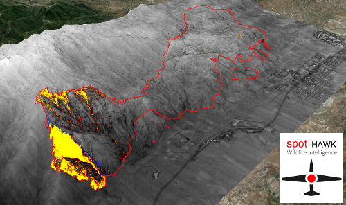
MAPS
 |
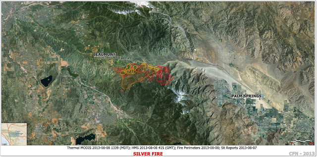
| SILVER FIRE RIVERSIDE COUNTY IMAGE PERIMETER MAP |
MEDIA: Incident command post is located at South end of 22nd Street and I-10.
 |
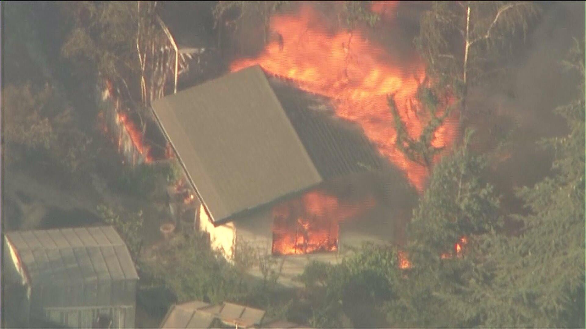
| #SilverFire near Banning Sky5 KTLA Credit: pic.twitter.com/8GMMmSgZE9 |
UPDATE 8-13 0900: 20,292 acres, 100% Contained
Cal Fire INT#6 (Kaslin) remains in Unified Command with USFS (Felix), Riverside County Fire Department (Hawkins) and Riverside County Sheriff’s Office (Peebles/Perdue).
Transition back to the Riverside Unit is scheduled today at 1800 hrs.
UPDATE 8-12 1900: 20,292 acres, 100% Contained
Cal Fire INT#6 (Kaslin) remains in Unified Command with USFS (Felix), Riverside County Fire Department (Hawkins) and Riverside County Sheriff’s Office (Peebles/Perdue).
Transition back to the Riverside Unit is scheduled today at 1800 hrs.
UPDATE 8-12 1900: 20,292 acres, 100% Contained
Cal Fire INT#6 (Kaslin) remains in Unified Command with USFS (Felix), Riverside County Fire Department (Hawkins) and Riverside County Sheriff’s Office (Peebles/Perdue.
UPDATE 8-10 0900: 19,000 acres, 47% ContainedCal Fire INT#6 (Kaslin) remains in Unified Command with USFS (Felix), Riverside County Fire Department (Hawkins) and Riverside County Sheriff’s Office (Peebles/Perdue).
Repopulation of Poppet Flats, Cabazon, Snow Peak, and Mt. Edna occurred.
UPDATE 8-9 1900: 18,000 acres, 40% ContainedCal Fire INT#6 (Kaslin) remains in Unified Command with USFS (Felix), Riverside County Fire Department (Hawkins) and Riverside County Sheriff’s Office (Peebles/Perdue). ICP remains at Noble Park. Fire did not spread. Damage inspection report is completed. Fire is holding on southeast side with only aerial retardant line. Significant progress made with crews completing, improving and holding fire line. Riverside County OES moved potable water into affected areas. Continue repairs of district water lines and electrical infrastructure. If fire does not roll or spot outside line, fire should be contained within 24 to 48 hours. Repopulation of communities Poppet Flats, Twin Pines, Silent Valley, Cabazon, and Snow Creek has begun.
UPDATE 8-9 0900: Cal Fire INT#6 (Kaslin) remains in Unified Command with USFS (Felix), Riverside County Fire Department (Hawkins) and Riverside County Sheriff’s Office (Peebles/Perdue). Incident Base is established at the Noble Creek Community Park.
UPDATE 2200: 17000 acres
UPDATE 20:00 RRU: There have been a total of five firefighters injured (unknown extent) and one civilian. There have been 26 homes and 1 commercial structure destroyed by the fire. 2 structures were damaged.
UPDATE 1935 RRU: The fire is now estimated at 14,000 acres and 20% contained.
UPDATE 20:00 OSCC: 14,000 acres, 20% Contained
Fire continues to move in eastward into the Snow Creek Drainage threatening residences in the Snow Creek Drainage and the San Jacinto Wilderness. Electrical transmission lines continue to be threatened as well as the communities of Poppet Flats, Twin Pines, Silent Valley, Cabazon, and Snow Creek. Fire behavior is backing, flanking and head fire with dangerous rates of spread through light and flashy fuels with short range spotting when aligned with wind and slope. With anticipated weather and poor RH recovery resources will be critical to continue fire suppression and slow forward spread. Cal Fire INT#6 entered into unified command with USFS (Felix) at 1700 hours today.The fire made a significant run to the east and increased in the size of 3,000 acres. Damage inspected has resulted in an increase number of structures damaged or destroyed.
UPDATE 14:45: 11,000+ acres 10%
UPDATE 12:55: During the initial attack phase of the "Silver" incident, a CAL FIRE dozer experienced problems that led to damage to the dozer from an internal fire. The operator was not injured.
Update 8-8 1020: #SILVERFIRE 10,000+ acres 10% cont., #evacuations continue with new evacuations ordered overnight portions of Cabazon.
Five people have been injured, including four firefighters and a civilian. On Wednesday, two firefighters were taken to hospitals by ambulance and the civilian, who was burned from head to toe, was airlifted to a burn center. Officials are not releasing any other details on those injuries. Two additional firefighters were injured overnight. #CaFire
Update 08-08-2013 0900
Due to the rapid growth of the Silver Fire, the Riverside County Sheriff's Department in cooperation with the CAL FIRE/Riverside County Fire Department/OES is updating the mandatory evacuation order for the following communities:
Update 8-8 0700: 6,500 acres 0% containedFire has critical rate of spread and has grown rapidly. Fire has split into two directions moving into Poppet Flats, Silent Valley Club, Twin Pines & Cabazon. Communities of Poppet Flats, Twin Pines, Silent Valley and Cabazon are under mandatory evacuations this morning using the Early Warning Notification System. Mt Edna repeater threated and local water district PVC lines, 115KV & 500 KV electrical transmission lines threatened, but no damage reported. Continue direct attack with hand line construction, dozer line and wet line. Implementing indirect attack when needed. Fixed wing operations continue flanking with retardant line. Expect rotary wing to continue water dropping missions with potential personnel and cargo transport missions. With predicted weather and minimal RH recovery the fire will continue to rapidly grow today.
Update 2130: Fire is now estimated at 6000 acres and 0% contained. There are three night flying helicopters (two from Los Angeles County and one from the USFS). The communities of Vista Grande and Mt. Edna are also under mandatory evacuation. The firefight continues throughout the night with over 500 personnel assigned.Reports 0ver a dozen homes burned, Citizens and Sheriffs Deputy trapped by fire rescued.
Update 2115: 5,000 acres, 0% Contained
The fire is in unified command with the San Bernardino National Forest, CAL FIRE and Riverside County Sheriff’s Office.
Evacuation Centers set up at Hemet High School and Beaumont High School.
Mandatory evacuations continue in Mount Edna. The Fire is currently burning on SRA lands with a threat to FRA. The Fire has burned in a 3 to 4 mile long strip of grass and brush in the old Esperanza Fire footprint. Multiple structures have been damaged or destroyed. 500 KV & 115 KV Electrical transmission lines are threatened. Mandatory evacuations are in affect for approximately 1500+ residents of Silent Valley, Mount Edna, and Poppet Flats. Shelters have been established at Hemet High School, and Beaumont High school. Highway 243 was closed by CHP
Update 1800: CalFire now confirms two firefighter injuries, and one civilian with injuries that required an airlift.Update 1730: Fire is now estimated at 5000 acres and 0% contained. Multiple structures involved in Twin Pines. One firefighter injury reported unknown extent.
Update 1700: MVU just sent 2 T3 Strike Teams
Update 1630: fire is running through Poppet Flats, taking some structures, has bumped Silent Valley club.
Update 1600: Fire is now estimated at 2,500 acres. IC requested second VLAT. No divert on aircraft due to imminent life threat
MEDIA: Incident command post is located at Hwy 243 and Wesley in Banning.
Update 1500: The fire is 300+ acres and burning at a critical rate.
Update 1445: The fire is estimated at 300+ acres. Additional updates will be posted as information becomes available.
CAL FIRE/Riverside County Firefighters are enroute to a wildland fire on Poppet Flats Rd, South of Banning. Updates will be posted as information becomes available
CAL FIRE/Riverside County Firefighters are enroute to a wildland fire on Poppet Flats Rd, South of Banning. Updates will be posted as information becomes available
INCIDENT INFORMATION FACT SHEET
Reported Date: Wednesday, August 07, 2013 2:05 PMIncident Number: CA-RRU-79781
Incident Location: Wolfskill Truck Trail and Mt Edna Road
Type: Wildland Fire
Community: South of BanningRiverside County Fire Department in cooperation with CAL FIRE
----------------------------
Incident Name: Silver Type of Incident: Wildland Fire
Incident Address: Wolfskill Truck Trail and Mt Edna Road Incident Number: CA-RRU-79781
Community: South of Banning Date Reported: 8/7/2013
Time Reported: 2:05 PM
Fatalities: 0 Major: 0 Moderate: 0 Minor: 0 Non Injury: 0
Transported Ground Ambulances: 0 Est. Containment Time:
Air Ambulance: 0 Est. Control Time:
Loss: $0.00
Saved: $0.00 Evacuations: Yes
Cause: Evacuation Comments: MANDATORY EVACUATIONS FOR THE COMMUNITIES OF: POPPET FLATS SILENT VALLEY TWIN PINES. Evacuation Center has been set up at Hemet High School 41701 East Stetson Avenue Hemet, CARiverside County Fire Incident Page http://www.rvcfire.org/_Layouts/Incident%20Information/IncidentInfoDetail.aspx?363
Resources Assigned
Firefighters: 450 Helicopters: 5 Utilities: No
Engine Companies: 71 Air Tankers: 4 + 2 VLAT Air Attack: Yes
Truck Companies: 0 Fire Crews: 14 OES: Yes
Overhead Personnel: 12 Water Tenders: 3 American Red Cross: Yes
Fire Investigator: Yes Bulldozers: 3 Displaced Persons: No
RVC Medics: 0 Ambulance Air: 0 Ground: 0
Specialized Equipment: Helitender,
Webcams: Toro Peak west cam: http://hpwren.ucsd.edu/cameras/L/tp-w-mobo-c.jpg
Toro Peak north cam: http://hpwren.ucsd.edu/cameras/L/tp-n-mobo-c.jpg
Toro Peak north cam: http://hpwren.ucsd.edu/cameras/L/tp-n-mobo-c.jpg
---------------------------------------------


